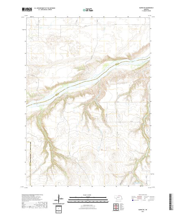
2021 Map of Naper SW
USGS Topo · Published 2021About this map
The Niobrara River winds across this north-central Nebraska landscape, marking a prominent boundary between Boyd and Holt counties. The terrain is defined by the erosion of the plains, where numerous drainages like Big Cr and Wright Cr feed into the river from the north, while the southern banks are broken by deeper incisions such as Cedar Gulch. This 2021 study illustrates a rural environment of section-line roads and sparse water management features. In the southeastern corner, JMK Reservoir Number 1 provides a localized water source near Beaver Cr, reflecting modern agricultural land use. To the west, the landscape remains dominated by the natural drainage patterns of Otter Cr and the complex branching of E Br Clay Cr and W Br Clay Cr, showing a region largely untouched by dense settlement.
Find a feature on this map
29 named features on this map. Tap any name to fly to it.
Don’t see what you’re looking for? This feature index may not catch every label — zoom into the map to look around manually.
Map Details
Editions of this 2021 Naper SW Map
This is the sole edition of this map. No revisions or reprints were ever made.
Other maps of this area

1950 · Mariaville
USGS Topo · 1:24,000

1951 · Naper
USGS Topo · 1:24,000

1951 · Dustin
USGS Topo · 1:24,000

1951 · Naper SW
USGS Topo · 1:24,000

1954 · Stuart NW
USGS Topo · 1:24,000

1954 · Newport NE
USGS Topo · 1:24,000

1954 · Stuart NE
USGS Topo · 1:24,000

1955 · O'Neill
USGS Topo · 1:250,000

1959 · O'Neill
USGS Topo · 1:250,000
1964 · Jamison
USGS Topo · 1:24,000