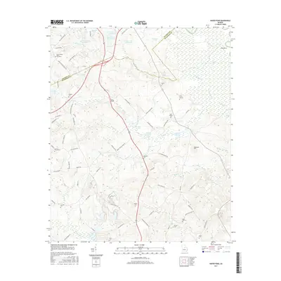
2017 Map of Napier Pond
USGS Topo · Published 2017About this map
Mount Pleasant Baptist Churchyard and a network of medical-related water features define the landscape of Baldwin County in the early 21st century. The northern reaches of the map show several large ponds associated with the local institution, including Georgia State Hospital Lake, Georgia State Hospital Lake W, and Hospital Lake Number One. This area is characterized by a high concentration of family and community burial grounds, such as Macedonia Cem and the Snow Hill Cemeteries, reflecting long-standing local lineages. The terrain is bisected by numerous waterways like Black Creek and Lords Br, which drain toward the Oconee River in the northeast. The settlement of Davis sits in the southwest, while infrastructure like Johns Bridge provides a vital link across the central creeks, illustrating the modern rural road network connecting these historic family landmarks.
Find a feature on this map
90 named features on this map. Tap any name to fly to it.
Don’t see what you’re looking for? This feature index may not catch every label — zoom into the map to look around manually.
Map Details
Editions of this 2017 Napier Pond Map
This is the sole edition of this map. No revisions or reprints were ever made.
Other maps of this area

1912 · Milledgeville
USGS Topo · 1:62,500

1916 · Irwinton
USGS Topo · 1:62,500

1920 · Irwinton
USGS Topo · 1:62,500

1953 · Athens
USGS Topo · 1:250,000

1956 · Gordon
USGS Topo · 1:62,500

1957 · Macon
USGS Topo · 1:250,000

1958 · Macon
USGS Topo · 1:250,000

1958 · Athens
USGS Topo · 1:250,000

1959 · Athens
USGS Topo · 1:250,000

1963 · Athens
USGS Topo · 1:250,000