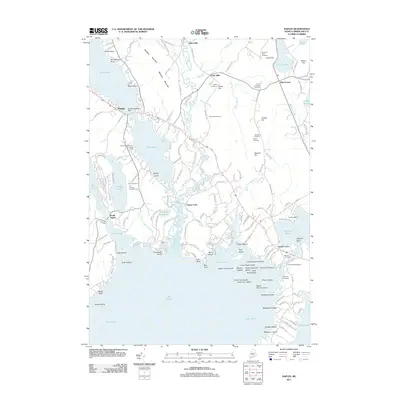
2011 Map of Naples
USGS Topo · Published 2011About this map
The waters of the Crooked River and Songo River define this part of Cumberland County, where the historic Songo Lock manages the passage between the Bay of Naples and the southern reaches of the quadrangle. The settlement pattern is anchored by the village of Naples and outlying communities like South Casco and Edes Falls. This 2011 survey reveals a landscape steeped in local history, marked by numerous family-named burial grounds including Tubbs Cemetery, Stimpson Cemetery, and Murch Cemetery. The terrain is characterized by prominent heights such as Madison Mountain and Quaker Hill, while the shoreline is dotted with named points like Thompson Point and Wards Point. Regional activity is further reflected in specialized landmarks such as the Naples Seaplane Base and the Thomas Pond Dam.
Find a feature on this map
151 named features on this map. Tap any name to fly to it.
Don’t see what you’re looking for? This feature index may not catch every label — zoom into the map to look around manually.
Map Details
Editions of this 2011 Naples Map
This is the sole edition of this map. No revisions or reprints were ever made.
Other maps of this area

1894 · Gray
USGS Topo · 1:62,500

1896 · Norway
USGS Topo · 1:62,500

1896 · Sebago
USGS Topo · 1:62,500

1898 · Gray
USGS Topo · 1:62,500

1908 · Poland
USGS Topo · 1:62,500

1940 · Poland
USGS Topo · 1:62,500

1942 · Poland
USGS Topo · 1:62,500

1942 · Gray
USGS Topo · 1:62,500

1942 · Sebago Lake
USGS Topo · 1:62,500

1943 · Sebago Lake
USGS Topo · 1:62,500