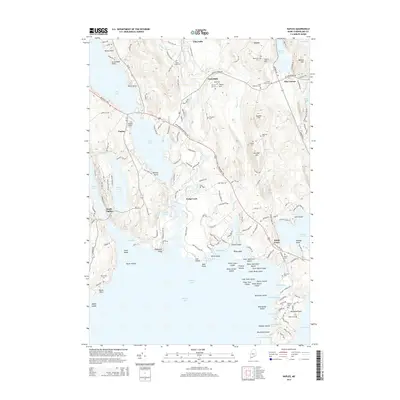
2014 Map of Naples
USGS Topo · Published 2014About this map
Sebago Lake and the Songo River anchor this landscape in Cumberland County, where the historic Songo Lock remains a critical point of navigation between larger water bodies. The settlement of Naples sits at the junction of Long Lake and the Bay of Naples, acting as a hub for both the local community and seasonal visitors. Moving northeast, the terrain rises toward Quaker Hill and Leach Hill, interspersed with small crossroads like Cook Mills and Pike Corner. This area is characterized by a high density of small family and community burying grounds, including Edes Falls Cem, Tubbs Cem, and the Murch Cem. The map shows a transition from the water-oriented activities of the lakeshore to the more wooded, elevated land of the interior, where geographic features like Barton Hill and Mitchell Hill define the local topography near the village of Casco.
Find a feature on this map
155 named features on this map. Tap any name to fly to it.
Don’t see what you’re looking for? This feature index may not catch every label — zoom into the map to look around manually.
Map Details
Editions of this 2014 Naples Map
This is the sole edition of this map. No revisions or reprints were ever made.
Other maps of this area

1894 · Gray
USGS Topo · 1:62,500

1896 · Norway
USGS Topo · 1:62,500

1896 · Sebago
USGS Topo · 1:62,500

1898 · Gray
USGS Topo · 1:62,500

1908 · Poland
USGS Topo · 1:62,500

1940 · Poland
USGS Topo · 1:62,500

1942 · Poland
USGS Topo · 1:62,500

1942 · Gray
USGS Topo · 1:62,500

1942 · Sebago Lake
USGS Topo · 1:62,500

1943 · Sebago Lake
USGS Topo · 1:62,500