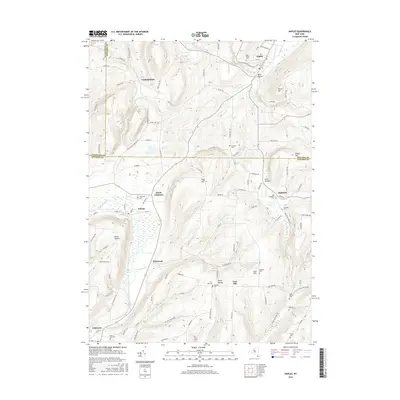
2016 Map of Naples
USGS Topo · Published 2016About this map
Naples sits at the northern edge of this Finger Lakes region landscape, where Grimes Cr and Eelpot Cr converge near the foot of Hatch Hill. The terrain is defined by deep valleys like Davis Hollow and Lyon Hollow, which historically dictated the paths of local roads and the placement of small agricultural hamlets. Settlements such as Atlanta, North Cohocton, and Ingleside are concentrated in the flatter southern basins along the Cohocton River. The map provides significant genealogical value through its numerous burial sites, ranging from the prominent Rose Ridge Cem in the north to family or neighborhood plots like Gerould Cem, Hatcher Cem, and Shults Cem. This 2016 survey illustrates the persistent rural character of the area where Ontario, Livingston, and Steuben counties meet.
Find a feature on this map
107 named features on this map. Tap any name to fly to it.
Don’t see what you’re looking for? This feature index may not catch every label — zoom into the map to look around manually.
Map Details
Editions of this 2016 Naples Map
This is the sole edition of this map. No revisions or reprints were ever made.
Other maps of this area

1900 · Naples
USGS Topo · 1:62,500

1902 · Wayland
USGS Topo · 1:62,500

1903 · Naples
USGS Topo · 1:62,500

1904 · Wayland
USGS Topo · 1:62,500

1910 · Bath
USGS Topo · 1:62,500

1913 · Naples
USGS Topo · 1:62,500

1915 · Hornell
USGS Topo · 1:62,500

1918 · Hornell
USGS Topo · 1:62,500

1942 · Springwater
USGS Topo · 1:31,680

1942 · Wayland
USGS Topo · 1:31,680