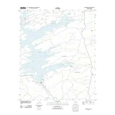
2011 Map of Narrows Dam
USGS Topo · Published 2011About this map
Lake Greeson dominates this landscape, its irregular shoreline reaching into the valleys formed by Daisy Creek, Bear Creek, and Skelton Creek. The massive reservoir is held back by the Narrows Dam on the Little Missouri River, a site flanked by local landmarks such as Dynamite Hill and Beacon Hill. To the northwest, the settlement of Daisy sits near the water's edge, while the eastern portion of the quadrangle is defined by rural roads and family-named terrain like Kirby Mountain and Funderburk Mountain. Several small burial grounds, including Kirby Cemetery and Hicks Cemetery, provide essential records for local genealogy near the Kirby Post Office. The presence of the Kirby Lookout Tower and the Lake Greeson Nursery Pond Dam indicates a region deeply tied to resource management and conservation in the early 21st century.
Find a feature on this map
78 named features on this map. Tap any name to fly to it.
Don’t see what you’re looking for? This feature index may not catch every label — zoom into the map to look around manually.
Map Details
Editions of this 2011 Narrows Dam Map
This is the sole edition of this map. No revisions or reprints were ever made.
Other maps of this area

1906 · Caddo Gap
USGS Topo · 1:125,000

1936 · Athens
USGS Topo · 1:48,000

1936 · Glenwood
USGS Topo · 1:48,000

1942 · Glenwood
USGS Topo · 1:62,500

1942 · Athens
USGS Topo · 1:62,500

1949 · Glenwood
USGS Topo · 1:62,500

1955 · Little Rock
USGS Topo · 1:250,000

1956 · Little Rock
USGS Topo · 1:250,000

1960 · Little Rock
USGS Topo · 1:250,000

1964 · Little Rock
USGS Topo · 1:250,000