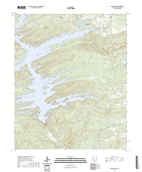
2024 Map of Narrows Dam
USGS Topo · Published 2024About this map
Lake Greeson dominates the central landscape of this Pike County quadrangle, where the Little Missouri River was impounded to create a massive, branched reservoir. Along the northern shores, the settlement of Daisy serves as a gateway to Daisy State Park - Area A, while the community of Kirby sits further east near the base of Kirby Mountain. The map reveals a high concentration of local burial sites, including Bear Creek Cem, Cummings Cem, and Midway Cem, which offer significant value for genealogical research in this rural timber and recreation region.
Find a feature on this map
147 named features on this map. Tap any name to fly to it.
Don’t see what you’re looking for? This feature index may not catch every label — zoom into the map to look around manually.
Map Details
Editions of this 2024 Narrows Dam Map
This is the sole edition of this map. No revisions or reprints were ever made.
Other maps of this area

1906 · Caddo Gap
USGS Topo · 1:125,000

1936 · Athens
USGS Topo · 1:48,000

1936 · Glenwood
USGS Topo · 1:48,000

1942 · Glenwood
USGS Topo · 1:62,500

1942 · Athens
USGS Topo · 1:62,500

1949 · Glenwood
USGS Topo · 1:62,500

1955 · Little Rock
USGS Topo · 1:250,000

1956 · Little Rock
USGS Topo · 1:250,000

1960 · Little Rock
USGS Topo · 1:250,000

1964 · Little Rock
USGS Topo · 1:250,000