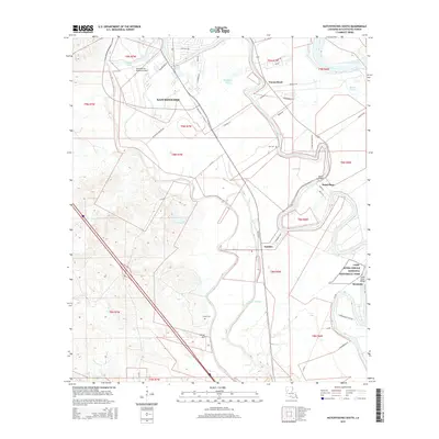
2015 Map of Natchitoches South
USGS Topo · Published 2015About this map
Cane River Creole National Historical Park anchors the southeastern landscape of this survey, preserving the unique cultural heritage of the Cane River region. The terrain is defined by the winding course of the Red River and complex local hydrology, including Vienna Bend, Chaplin Lake, and Bayou Poisson. The southern periphery of Natchitoches transitions into smaller settlements and riverfront communities like Natchez, Point Place, and Bermuda, where the Cane River Bridge provides a vital local crossing. Genealogists can identify significant landmarks such as Lee Cem and Camel Cem near Camel Hill. The transport network relies on a mix of parish roads and historic routes, while the Natchitoches Regional Airport marks the modern utility of the northern reaches of this Louisiana parish.
Find a feature on this map
42 named features on this map. Tap any name to fly to it.
Don’t see what you’re looking for? This feature index may not catch every label — zoom into the map to look around manually.
Map Details
Editions of this 2015 Natchitoches South Map
This is the sole edition of this map. No revisions or reprints were ever made.
Other maps of this area

1935 · Hagewood
USGS Topo · 1:31,680

1937 · Bermuda
USGS Topo · 1:31,680

1937 · Campti SE
USGS Topo · 1:31,680

1937 · Bellwood
USGS Topo · 1:31,680

1937 · Montgomery
USGS Topo · 1:62,500

1937 · Campti SW
USGS Topo · 1:31,680

1937 · Cloutierville
USGS Topo · 1:31,680

1937 · Cypress
USGS Topo · 1:31,680

1942 · Montgomery
USGS Topo · 1:62,500

1943 · Provencal
USGS Topo · 1:62,500