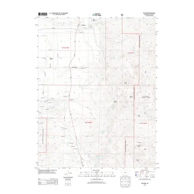
2013 Map of Nathrop
USGS Topo · Published 2013About this map
Nathrop and the surrounding high-altitude basin of the Arkansas River are defined by a complex irrigation network and geothermal activity. The settlement of Centerville remains a focal point for local history, anchored by the Centerville Cem and flanked by the Bowen Ditch and Pioneer Ditch, which redirect water across this arid landscape. To the south, the terrain descends into the dramatic Browns Canyon, where the Browns Canyon Warm Spring and Browns Grotto Warm Spring emerge near the riverbanks.
Find a feature on this map
68 named features on this map. Tap any name to fly to it.
Don’t see what you’re looking for? This feature index may not catch every label — zoom into the map to look around manually.
Map Details
Editions of this 2013 Nathrop Map
This is the sole edition of this map. No revisions or reprints were ever made.
Other maps of this area

1954 · Pueblo
USGS Topo · 1:250,000

1955 · Buena Vista
USGS Topo · 1:62,500

1956 · Cameron Mountain
USGS Topo · 1:62,500

1956 · Poncha Springs
USGS Topo · 1:62,500

1956 · Montrose
USGS Topo · 1:250,000

1957 · Pueblo
USGS Topo · 1:250,000

1958 · Pueblo
USGS Topo · 1:250,000

1959 · Montrose
USGS Topo · 1:250,000

1959 · Antero Reservoir
USGS Topo · 1:62,500

1960 · Montrose
USGS Topo · 1:250,000