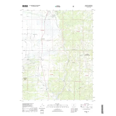
2019 Map of Nathrop
USGS Topo · Published 2019About this map
The settlement of Centerville and the rugged topography of Browns Canyon define this high-altitude landscape along the Arkansas River. As of 2019, the region remains a complex network of agricultural irrigation and protected wilderness, with historic water systems like the Pioneer Ditch, Salida Ditch, and Kraft Ditch carving through the terrain to support local ranching. Geologic features and geothermal activity are prominent, marked by the presence of Browns Canyon Warm Spring and Browns Grotto Warm Spring nestled near the river's path. Local history is anchored by the Centerville Cem, located just west of the main cluster of roads. To the east, the San Isabel National Forest encompasses dramatic landforms such as The Reef and Ruby Mtn. River enthusiasts can identify specific features like Seidel's Suckhole Rapid, while land access is detailed through an extensive series of county roads and the Ruby Mountain Trail.
Find a feature on this map
67 named features on this map. Tap any name to fly to it.
Don’t see what you’re looking for? This feature index may not catch every label — zoom into the map to look around manually.
Map Details
Editions of this 2019 Nathrop Map
This is the sole edition of this map. No revisions or reprints were ever made.
Other maps of this area

1954 · Pueblo
USGS Topo · 1:250,000

1955 · Buena Vista
USGS Topo · 1:62,500

1956 · Cameron Mountain
USGS Topo · 1:62,500

1956 · Poncha Springs
USGS Topo · 1:62,500

1956 · Montrose
USGS Topo · 1:250,000

1957 · Pueblo
USGS Topo · 1:250,000

1958 · Pueblo
USGS Topo · 1:250,000

1959 · Montrose
USGS Topo · 1:250,000

1959 · Antero Reservoir
USGS Topo · 1:62,500

1960 · Montrose
USGS Topo · 1:250,000