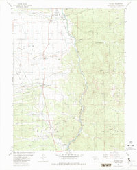
1983 Map of Nathrop
USGS Topo · Published 1983About this map
Nathrop and Centerville anchor this mountain corridor where the high plains meet the eastern edge of the San Isabel National Forest. The landscape is dominated by the Arkansas River as it carves through Browns Canyon, a geological feature flanked by the Denver and Rio Grande Western Railroad. This rail line and the nearby Hecla Junction speak to the region's historical role as a transit and shipping hub for local industry. The map captures a detailed inventory of the area's geography, from the volcanic rise of Ruby Mtn to the numerous watercourses like Chalk Creek and Raspberry Gulch. For genealogists and local historians, the inclusion of the Centerville Cem and various gravel pits and mining prospects provides specific points of interest for tracing the early industrial and community footprint in Chaffee County.
Find a feature on this map
30 named features on this map. Tap any name to fly to it.
Don’t see what you’re looking for? This feature index may not catch every label — zoom into the map to look around manually.
Map Details
Editions of this 1983 Nathrop Map
This is the sole edition of this map. No revisions or reprints were ever made.
Other maps of this area

1954 · Pueblo
USGS Topo · 1:250,000

1955 · Buena Vista
USGS Topo · 1:62,500

1956 · Cameron Mountain
USGS Topo · 1:62,500

1956 · Poncha Springs
USGS Topo · 1:62,500

1956 · Montrose
USGS Topo · 1:250,000

1957 · Pueblo
USGS Topo · 1:250,000

1958 · Pueblo
USGS Topo · 1:250,000

1959 · Montrose
USGS Topo · 1:250,000

1959 · Antero Reservoir
USGS Topo · 1:62,500

1960 · Montrose
USGS Topo · 1:250,000