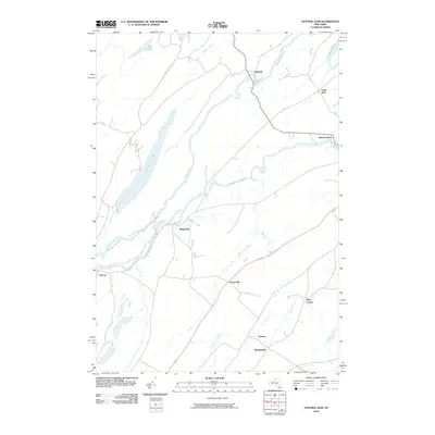
2010 Map of Natural Dam
USGS Topo · Published 2010About this map
The Oswegatchie River serpentines through this St. Lawrence County landscape, dictating the placement of several small settlements and rural crossroads. The namesake hamlet of Natural Dam sits at a sharp bend in the river in the northeast, while further downstream, the water wraps around the community of Oxbow. The geography is defined by a series of long, narrow water bodies and wetlands oriented southwest-to-northeast, most notably Yellow Lake and the marshy margins of Mud Lake.
Find a feature on this map
16 named features on this map. Tap any name to fly to it.
Don’t see what you’re looking for? This feature index may not catch every label — zoom into the map to look around manually.
Map Details
Editions of this 2010 Natural Dam Map
This is the sole edition of this map. No revisions or reprints were ever made.
Other maps of this area

1911 · Antwerp
USGS Topo · 1:62,500

1912 · Hammond
USGS Topo · 1:62,500

1913 · Lake Bonaparte
USGS Topo · 1:62,500

1915 · Gouverneur
USGS Topo · 1:62,500

1916 · Lake Bonaparte
USGS Topo · 1:62,500

1937 · Gouverneur
USGS Topo · 1:62,500

1944 · Hammond
USGS Topo · 1:62,500

1948 · Ogdensburg
USGS Topo · 1:250,000

1949 · Hammond
USGS Topo · 1:62,500

1949 · Antwerp
USGS Topo · 1:62,500