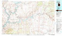
1981 Map of Navajo Mountain
USGS Topo · Published 1982About this map
Lake Powell dominates the center of this landscape, winding through the complex drainages where the Colorado River and San Juan River meet. At the southern edge of the map, the high elevation of Navajo Mountain rises above the Rainbow Plateau and the Navajo Indian Reservation. This 1980s-era topographic survey captures the area after the flooding of the canyon systems, showing the established recreational boundaries of the Glen Canyon National Recreation Area alongside significant natural landmarks like Rainbow Bridge and the Waterpocket Fold. Cultural features are concentrated near the periphery, including the Navajo Mountain School and the settlement at Goulding near Monument Valley. The map also details isolated industrial and natural interests, from the Sunwind Mine to various springs and washes like Oljeto Wash and Moqui Creek.
Find a feature on this map
87 named features on this map. Tap any name to fly to it.
Don’t see what you’re looking for? This feature index may not catch every label — zoom into the map to look around manually.
Map Details
Editions of this 1981 Navajo Mountain Map
This is the sole edition of this map. No revisions or reprints were ever made.
Other maps of this area

1883 · Marsh Pass
USGS Topo · 1:250,000

1886 · Escalante
USGS Topo · 1:250,000

1886 · Henry Mountains
USGS Topo · 1:250,000

1886 · Abajo
USGS Topo · 1:250,000

1886 · Echo Cliffs
USGS Topo · 1:250,000

1891 · Echo Cliffs
USGS Topo · 1:250,000

1892 · Marsh Pass
USGS Topo · 1:250,000

1892 · Abajo
USGS Topo · 1:250,000

1892 · Henry Mountains
USGS Topo · 1:250,000

1892 · Canyon De Chelly
USGS Topo · 1:250,000
Featured Places
- Oljeto (Moonlight Water), UT
- Navajo Mountain, UT
- Clay Hills Crossing, UT
- Halls Crossing, UT
- Navajo Mountain, UT