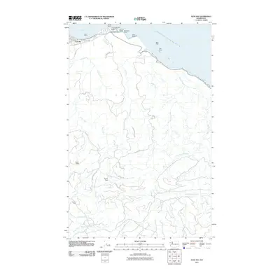
2011 Map of Neah Bay
USGS Topo · Published 2011About this map
Neah Bay serves as the focal point of this coastal landscape on the Olympic Peninsula, where the Makah Bureau of Indian Affairs Agency and the Makah Marina anchor the local maritime economy. The map illustrates the shoreline where the Strait of Juan de Fuca meets rugged headlands like Baada Point and Klachopis Point. Inland, the terrain is defined by the Makah Peaks and Sooes Peak, with drainage networks including the Waatch River and the Sooes River flowing toward the coast. A network of forestry and access roads, such as 500 Line Rd and the Makah Indian Res Rd, crisscrosses the timbered interior. Remote homesteading and land use are evidenced by the Washburn Ranch located near Grimes Creek in the southwestern quadrant, providing a detailed look at the interface between traditional tribal lands and the natural geography of Washington's northwestern tip.
Find a feature on this map
43 named features on this map. Tap any name to fly to it.
Don’t see what you’re looking for? This feature index may not catch every label — zoom into the map to look around manually.
Map Details
Editions of this 2011 Neah Bay Map
This is the sole edition of this map. No revisions or reprints were ever made.
Other maps of this area

1935 · Clallam
USGS Topo · 1:62,500

1935 · Ozette Lake
USGS Topo · 1:62,500

1935 · Lake Pleasant
USGS Topo · 1:62,500

1938 · Cape Flattery
USGS Topo · 1:62,500

1942 · Clallam
USGS Topo · 1:62,500

1942 · Ozette Lake
USGS Topo · 1:62,500

1942 · Lake Pleasant
USGS Topo · 1:62,500

1953 · Cape Flattery
USGS Topo · 1:250,000

1956 · Ozette Lake
USGS Topo · 1:62,500

1957 · Lake Pleasant
USGS Topo · 1:62,500