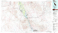
1985 Map of Needles
USGS Topo · Published 1985About this map
The Colorado River serves as the central artery for this mid-1980s landscape, weaving between the high peaks of the Sacramento Mountains and the Black Mountains. The settlement at Needles stands as a primary desert hub, where the Atchison Topeka and Santa Fe railroad and Interstate 40 converge near the Fort Mojave Indian Reservation. Further south, the river expands into Lake Havasu, supporting the growing footprint of Lake Havasu City and the protected lands of the Havasu National Wildlife Refuge.
Find a feature on this map
54 named features on this map. Tap any name to fly to it.
Don’t see what you’re looking for? This feature index may not catch every label — zoom into the map to look around manually.
Map Details
Editions of this 1985 Needles Map
This is the sole edition of this map. No revisions or reprints were ever made.
Other maps of this area

1886 · Diamond Creek
USGS Topo · 1:250,000

1886 · Camp Mohave
USGS Topo · 1:250,000

1892 · Diamond Creek
USGS Topo · 1:250,000

1892 · Camp Mohave
USGS Topo · 1:250,000

1903 · Needles
USGS Topo · 1:125,000

1904 · Needles Special
USGS Topo · 1:125,000

1910 · Ivanpah
USGS Topo · 1:250,000

1911 · Parker
USGS Topo · 1:125,000

1912 · Ivanpah
USGS Topo · 1:250,000

1923 · Signal
USGS Topo · 1:250,000