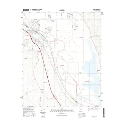
2015 Map of Needles
USGS Topo · Published 2015About this map
The Colorado River defines the border between California and Arizona in this 2015 survey, flowing through the Mojave Valley and past the historic transit hub of Needles. On the California side, the landscape is shaped by the presence of Riverview Cemetery and the Needles Airport, while across the river in Mohave County, Arizona Village sits near the Fort Mojave Burial Grounds. The map illustrates a complex network of desert roads and water features, including Japanese Slough, Threemile Lake, and the curiously named The Glory Hole. Local infrastructure is further detailed by Beal Ditch and the junction of major travel corridors at Parker Junction. The transition from the developed town grid of Needles to the open Mojave Desert and the recreational access at Fivemile Landing highlights the dual character of this river-border region.
Find a feature on this map
90 named features on this map. Tap any name to fly to it.
Don’t see what you’re looking for? This feature index may not catch every label — zoom into the map to look around manually.
Map Details
Editions of this 2015 Needles Map
This is the sole edition of this map. No revisions or reprints were ever made.
Other maps of this area

1903 · Needles
USGS Topo · 1:125,000

1904 · Needles Special
USGS Topo · 1:125,000

1943 · Topock
USGS Topo · 1:62,500

1950 · Topock
USGS Topo · 1:62,500

1950 · Sawtooth Range
USGS Topo · 1:62,500

1950 · Needles
USGS Topo · 1:62,500

1951 · Topock
USGS Topo · 1:62,500

1951 · Sawtooth Range
USGS Topo · 1:62,500

1952 · Needles
USGS Topo · 1:62,500

1954 · Needles
USGS Topo · 1:250,000