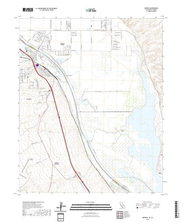
2021 Map of Needles
USGS Topo · Published 2021About this map
The Colorado River defines the border between California and Arizona on this 2021 survey, winding through the Mojave Desert and supporting a complex network of wetlands. On the western bank, the city of Needles serves as a transportation hub where the BNSF Railway and Interstate 40 intersect near the Needles Riverview Cem. Across the water, Arizona Village sits on the Fort Mojave Reservation, while the Fort Mojave Burial Grounds provide a significant cultural landmark for the area. The landscape to the east is dominated by the sprawling Topock Marsh and Goose Lake, a vast aquatic ecosystem that includes curiously named features like The Glory Hole and the Beal Ditch. This modern record traces the ongoing relationship between desert settlements and the vital river corridor, from Needles Airport in the south to the residential streets of Mohave Valley.
Find a feature on this map
106 named features on this map. Tap any name to fly to it.
Don’t see what you’re looking for? This feature index may not catch every label — zoom into the map to look around manually.
Map Details
Editions of this 2021 Needles Map
This is the sole edition of this map. No revisions or reprints were ever made.
Other maps of this area

1903 · Needles
USGS Topo · 1:125,000

1904 · Needles Special
USGS Topo · 1:125,000

1943 · Topock
USGS Topo · 1:62,500

1950 · Topock
USGS Topo · 1:62,500

1950 · Sawtooth Range
USGS Topo · 1:62,500

1950 · Needles
USGS Topo · 1:62,500

1951 · Topock
USGS Topo · 1:62,500

1951 · Sawtooth Range
USGS Topo · 1:62,500

1952 · Needles
USGS Topo · 1:62,500

1954 · Needles
USGS Topo · 1:250,000