
1950 Map of Needles
USGS Topo · Published 1957About this map
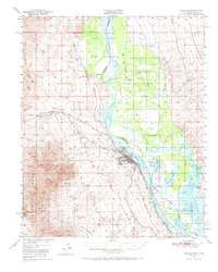
The Colorado River serves as the central artery of this mid-century desert landscape, defining the state boundary between California and Arizona. Near the hub of Needles, transportation networks converge where the Atchison Topeka and Santa Fe Railway and the legendary U.S. 66 follow the river's path. To the north, the Fort Mohave Indian Reservation spans the river valley, while the southern reaches show the early preservation efforts of the Havasu Lake National Wildlife Refuge. The terrain is marked by the stark Dead Mountains and Sacramento Mountains, which contain evidence of early industrial activity like the Mingus Mine and various quarries. Between the mountain ranges, the floodplain is dotted with local landmarks such as Soto Ranch and the Riverview Cem, providing a detailed look at the rural and transit-oriented development of the Mojave Desert region.
Find a feature on this map
33 named features on this map. Tap any name to fly to it.
Don’t see what you’re looking for? This feature index may not catch every label — zoom into the map to look around manually.
Map Details
Editions of this 1950 Needles Map
2 editions found
Other maps of this area

1886 · Camp Mohave
USGS Topo · 1:250,000

1892 · Camp Mohave
USGS Topo · 1:250,000

1903 · Needles
USGS Topo · 1:125,000

1904 · Needles Special
USGS Topo · 1:125,000

1926 · Mohave City
USGS Topo · 1:96,000

1942 · Camp Mohave
USGS Topo · 1:250,000

1943 · Center Hills
USGS Topo · 1:62,500

1943 · Topock
USGS Topo · 1:62,500

1943 · Bannock
USGS Topo · 1:62,500

1947 · Kingman
USGS Topo · 1:250,000