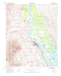
1950 Map of Needles
USGS Topo · Published 1968About this map
The Colorado River defines this landscape, separating the California desert from the Fort Mohave Indian Reservation and the Arizona borderlands. In the 1950s, the city of Needles serves as the central hub, where the Atchison Topeka and Santa Fe Railway meets the National Old Trails Road. This era shows the region’s reliance on the river’s complex hydraulics, evidenced by named sloughs like Japanese Slough and Harpers Slough, and the expansive Havasu Lake National Wildlife Refuge.
Find a feature on this map
33 named features on this map. Tap any name to fly to it.
Don’t see what you’re looking for? This feature index may not catch every label — zoom into the map to look around manually.
Map Details
Editions of this 1950 Needles Map
2 editions found

Other maps of this area

1886 · Camp Mohave
USGS Topo · 1:250,000

1892 · Camp Mohave
USGS Topo · 1:250,000

1903 · Needles
USGS Topo · 1:125,000

1904 · Needles Special
USGS Topo · 1:125,000

1926 · Mohave City
USGS Topo · 1:96,000

1942 · Camp Mohave
USGS Topo · 1:250,000

1943 · Center Hills
USGS Topo · 1:62,500

1943 · Topock
USGS Topo · 1:62,500

1943 · Bannock
USGS Topo · 1:62,500

1947 · Kingman
USGS Topo · 1:250,000