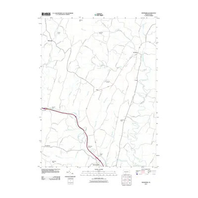
2010 Map of Needmore
USGS Topo · Published 2010About this map
Warfordsburg and Needmore anchor this section of Fulton County, where the topography is defined by the prominent ridge of Sideling Hill and the winding course of Little Tonoloway Creek. The landscape transition from high ground to fertile valley is evident in named pockets like Whips Cove and Lynn Run Hollow. The area maintains its rural character through numerous family-named landmarks and local roadways like Fischer Rd and Plessinger Rd.
Find a feature on this map
72 named features on this map. Tap any name to fly to it.
Don’t see what you’re looking for? This feature index may not catch every label — zoom into the map to look around manually.
Map Details
Editions of this 2010 Needmore Map
This is the sole edition of this map. No revisions or reprints were ever made.
Other maps of this area

1898 · Paw Paw
USGS Topo · 1:62,500

1899 · Hancock
USGS Topo · 1:62,500

1900 · Pawpaw
USGS Topo · 1:62,500

1901 · Hancock
USGS Topo · 1:62,500

1910 · Paw Paw
USGS Topo · 1:62,500

1925 · Needmore
USGS Topo · 1:48,000

1927 · Clearville
USGS Topo · 1:48,000

1931 · Clearville
USGS Topo · 1:62,500

1935 · Needmore
USGS Topo · 1:62,500

1939 · Needmore
USGS Topo · 1:62,500
Featured Places
- Bethel Township, PA
- Thompson Township, PA
- Brush Creek Township, PA
- Belfast Township, PA
- Stonybreak, Bethel Township