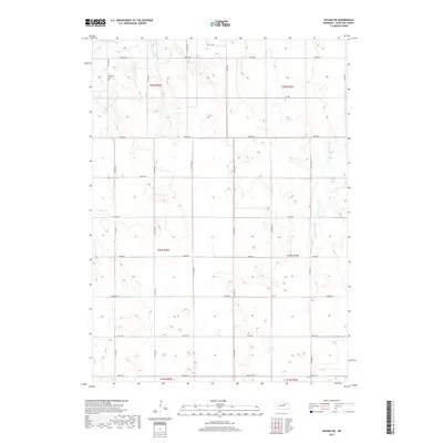
2017 Map of Neligh SW
USGS Topo · Published 2017About this map
Lutheran Cem stands as a primary landmark in this rural landscape of northern Nebraska, positioned near the intersection of 513th Ave and 848th Rd. The area is characterized by a high-density grid of gravel section roads, reflecting the systematic land division of the Public Land Survey System across townships like t25n r8w and t24n r7w. Several waterways carve through the terrain, including Clearwater Cr and Snake Cr, which likely served as critical drainage and water sources for the surrounding agricultural operations. This 2017 survey provides a detailed record of the contemporary rural infrastructure in Antelope County, documenting the exact placement of local avenues and roads that connect the dispersed farmsteads of the region.
Find a feature on this map
28 named features on this map. Tap any name to fly to it.
Don’t see what you’re looking for? This feature index may not catch every label — zoom into the map to look around manually.
Map Details
Editions of this 2017 Neligh SW Map
This is the sole edition of this map. No revisions or reprints were ever made.
Other maps of this area

1955 · Broken Bow
USGS Topo · 1:250,000

1955 · O'Neill
USGS Topo · 1:250,000

1956 · Broken Bow
USGS Topo · 1:250,000

1959 · O'Neill
USGS Topo · 1:250,000

1960 · Spalding 2 NE
USGS Topo · 1:24,000

1963 · Neligh
USGS Topo · 1:24,000

1963 · Neligh SE
USGS Topo · 1:24,000

1963 · Deloit
USGS Topo · 1:24,000

1963 · Neligh SW
USGS Topo · 1:24,000

1963 · Elgin NW
USGS Topo · 1:24,000