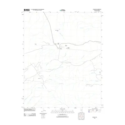
2012 Map of Nelson
USGS Topo · Published 2012About this map
The mining history of Eldorado Canyon defines this desert landscape, anchored by the settlement of Nelson and the prominent Eldorado Mine. The map reveals a network of industrial outposts such as Marie Camp, Lucky Jim Camp, and Capitol Camp, which are connected by ephemeral drainages including Techatticup Wash and Morning Star Wash. These camps and diggings illustrate the intensive mineral exploration that once dominated this portion of Clark County.
Find a feature on this map
25 named features on this map. Tap any name to fly to it.
Don’t see what you’re looking for? This feature index may not catch every label — zoom into the map to look around manually.
Map Details
Editions of this 2012 Nelson Map
This is the sole edition of this map. No revisions or reprints were ever made.
Other maps of this area

1886 · Camp Mohave
USGS Topo · 1:250,000

1892 · Camp Mohave
USGS Topo · 1:250,000

1926 · Nelson
USGS Topo · 1:96,000

1942 · Camp Mohave
USGS Topo · 1:250,000

1947 · Kingman
USGS Topo · 1:250,000

1948 · Kingman
USGS Topo · 1:250,000

1954 · Kingman
USGS Topo · 1:250,000

1955 · Kingman
USGS Topo · 1:250,000

1958 · Kingman
USGS Topo · 1:250,000
1958 · Boulder City SW
USGS Topo · 1:24,000