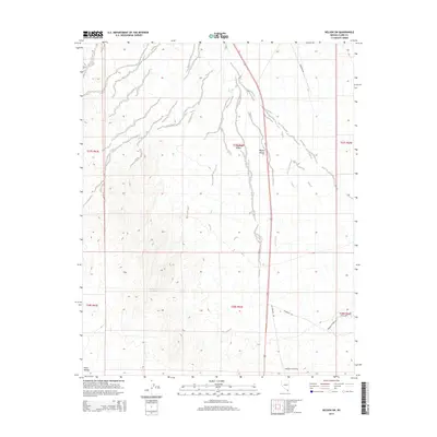
2014 Map of Nelson SW
USGS Topo · Published 2014About this map
Ten Mile Spring and Bell Number Two Spring stand as critical water sources in this arid stretch of Clark County, marking the transition where the Eldorado Valley meets the northern reaches of the Piute Valley. This 2014 survey captures a landscape defined by expansive desert basins and the infrastructure that crosses them, including the prominent Gas Pipeline Rd which runs nearly the entire north-south length of the sheet. The network of local desert tracks, such as Grandpa's Rd and Rocking S Ranch Rd, indicates scattered rural access points and private interests within the broader Mojave Desert environment. The map provides a precise look at the township and range divisions that structure this part of southern Nevada, useful for understanding land use and boundary history in an area predominantly shaped by its natural topography.
Find a feature on this map
16 named features on this map. Tap any name to fly to it.
Don’t see what you’re looking for? This feature index may not catch every label — zoom into the map to look around manually.
Map Details
Editions of this 2014 Nelson SW Map
This is the sole edition of this map. No revisions or reprints were ever made.
Other maps of this area

1886 · Camp Mohave
USGS Topo · 1:250,000

1892 · Camp Mohave
USGS Topo · 1:250,000

1910 · Ivanpah
USGS Topo · 1:250,000

1912 · Ivanpah
USGS Topo · 1:250,000

1926 · Nelson
USGS Topo · 1:96,000

1926 · Mohave City
USGS Topo · 1:96,000

1942 · Camp Mohave
USGS Topo · 1:250,000

1942 · Ivanpah
USGS Topo · 1:250,000

1947 · Kingman
USGS Topo · 1:250,000

1948 · Kingman
USGS Topo · 1:250,000