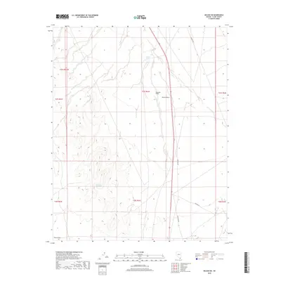
2018 Map of Nelson SW
USGS Topo · Published 2018About this map
Eldorado Valley and the northern reaches of Piute Valley dominate this arid landscape within the Mojave Desert. The map reveals a land defined by its vital water sources, specifically Ten Mile Spring and Bell Number Two Spring, which serve as the primary landmarks in this sparsely populated region of Clark County. Human infrastructure is limited to long-distance utility and access corridors, most notably the Gas Pipeline Rd and the local route identified as Grandpa's Rd. The terrain is characterized by broad alluvial basins and intermittent drainage patterns, reflecting the harsh environmental realities of the southern Nevada desert during this 2018 survey. The grid of township and range lines provides the only formal organization over these open stretches of public land.
Find a feature on this map
14 named features on this map. Tap any name to fly to it.
Don’t see what you’re looking for? This feature index may not catch every label — zoom into the map to look around manually.
Map Details
Editions of this 2018 Nelson SW Map
This is the sole edition of this map. No revisions or reprints were ever made.
Other maps of this area

1886 · Camp Mohave
USGS Topo · 1:250,000

1892 · Camp Mohave
USGS Topo · 1:250,000

1910 · Ivanpah
USGS Topo · 1:250,000

1912 · Ivanpah
USGS Topo · 1:250,000

1926 · Nelson
USGS Topo · 1:96,000

1926 · Mohave City
USGS Topo · 1:96,000

1942 · Camp Mohave
USGS Topo · 1:250,000

1942 · Ivanpah
USGS Topo · 1:250,000

1947 · Kingman
USGS Topo · 1:250,000

1948 · Kingman
USGS Topo · 1:250,000