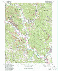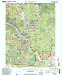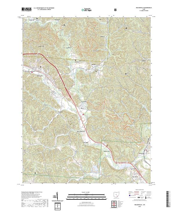
2023 Map of Nelsonville
USGS Topo · Published 2023About this map
Nelsonville and the surrounding coal-country settlements of the Wayne National Forest are documented here along the winding course of the Hocking River. The landscape is a network of ridges and hollows, where the heritage of extraction is visible through numerous cemeteries like Carbon Hill Cem and Buchtel Cem that serve small communities such as Doanville, Buchtel, and Orbiston. The industrial footprint is evident at the Columbus and Southern Ohio Electric Company Ash Pond near The Plains, contrasting with the modern recreational and educational hubs like Hocking College. A dense system of trails, including the Main Corridor Trl and Wild Turkey Trl, weaves through the steep terrain of Bethel Ridge and Utah Ridge, following the historic paths of former mining and rail corridors. This modern topographical study illustrates how 21st-century conservation and education have layered over the older settlement patterns of Athens and Hocking counties.
Find a feature on this map
87 named features on this map. Tap any name to fly to it.
Don’t see what you’re looking for? This feature index may not catch every label — zoom into the map to look around manually.
Map Details
Editions of this 2023 Nelsonville Map
This is the sole edition of this map. No revisions or reprints were ever made.
Historical Maps of Candy Town Through Time
3 maps found