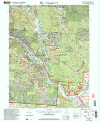
2002 Map of Nelsonville
USGS Topo · Published 2006About this map
The Hocking River valley anchors this area of southeastern Ohio, flowing through the heart of Nelsonville. This terrain is deeply defined by the coal and clay heritage of the Hocking Valley, evidenced by the presence of Strip Mine operations and the Chesapeake and Ohio railroad corridor that historically served the region's industry. Small communities like Buchtel, Doanville, and Chauncey line the river and its tributaries, reflecting a settlement pattern tied closely to the valley floor. Higher elevations are largely encompassed by the Wayne National Forest, featuring an extensive network of hollows such as Snake Hollow and Minkers Run. Local landmarks like Hocking Technical College and Doctors Hospital mark the modern growth of Nelsonville, while the Indian Mound near The Plains indicates a much older layer of human history.
Find a feature on this map
61 named features on this map. Tap any name to fly to it.
Don’t see what you’re looking for? This feature index may not catch every label — zoom into the map to look around manually.
Map Details
Editions of this 2002 Nelsonville Map
This is the sole edition of this map. No revisions or reprints were ever made.
Other maps of this area

1903 · Athens
USGS Topo · 1:62,500

1904 · Zaleski
USGS Topo · 1:62,500

1905 · Athens
USGS Topo · 1:62,500

1907 · Zaleski
USGS Topo · 1:62,500

1907 · Logan
USGS Topo · 1:62,500

1909 · Logan
USGS Topo · 1:62,500

1911 · New Lexington
USGS Topo · 1:62,500

1947 · Columbus
USGS Topo · 1:250,000

1961 · Columbus
USGS Topo · 1:250,000

1961 · Nelsonville
USGS Topo · 1:24,000