Loading...
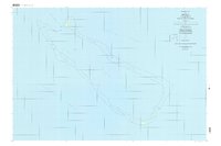
Loading map...1996 Map of Neoch
USGS Topo · Published 2004About this map
The isolated coral atoll of Neoch in the Pacific Ocean is revealed in this mid-1990s survey, showing the delicate relationship between the surrounding coral reef and the small islands that emerge along its perimeter. As part of the State of Chuuk, the map documents several distinct landforms including Feneppi and Ipis, which are among the most prominent points of dry land in this expansive marine environment.
Find a feature on this map
14 named features on this map. Tap any name to fly to it.
Don’t see what you’re looking for? This feature index may not catch every label — zoom into the map to look around manually.
Map Details
Date Portrayed1996
Date Published2004
PublisherU.S. Geological Survey
Map TypeTopographic
Scale1:25,000
Physical Dimensions48.01 x 31.89 inches
Editions of this 1996 Neoch Map
This is the sole edition of this map. No revisions or reprints were ever made.
Other maps of this area
Featured Places
Source Details
SourceU.S. Geological Survey
CopyrightPublic Domain