2023 Map of Nevada
USGS Topo · Published 2023About this map
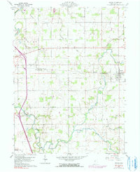
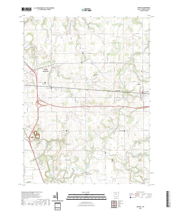
Upper Sandusky anchors the western edge of this landscape, where the Sandusky River begins its northward trek through Wyandot County. The area is defined by a dense concentration of historical burial sites that speak to the long habitation of this territory. Genealogists and historians will find significant points of interest in the Wyandot Indian Cem and the Pipetown Indian Number One Cem, alongside numerous family and pioneer plots like Salem Cem and Gilliland Cem. The rural fabric is further established by smaller hubs like Nevada and Edenville, connected by a grid of township and county highways. Drainage patterns from Broken Sword Creek and Cranberry Run crisscross the farmland, while the southern boundary reaches the edge of Harpster. This survey provides a precise look at the modern layout of these historic townships, including T2S R14E and T2S R15E, reflecting centuries of continuous agricultural and civic development.
Find a feature on this map
43 named features on this map. Tap any name to fly to it.
Don’t see what you’re looking for? This feature index may not catch every label — zoom into the map to look around manually.
Map Details
Editions of this 2023 Nevada Map
This is the sole edition of this map. No revisions or reprints were ever made.