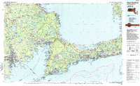
1986 Map of New Bedford
USGS Topo · Published 1986About this map
Otis Air Force Base and the Cape Cod Canal anchor this mid-1980s regional overview, which spans the industrial waterfront of New Bedford to the furthest reaches of the Cape Cod National Seashore. The map captures a significant period of coastal development, documenting the established road networks of the Mid Cape Highway and Interstate 195 alongside the Conrail lines that still served the region's commerce.
Find a feature on this map
74 named features on this map. Tap any name to fly to it.
Don’t see what you’re looking for? This feature index may not catch every label — zoom into the map to look around manually.
Map Details
Editions of this 1986 New Bedford Map
This is the sole edition of this map. No revisions or reprints were ever made.
Other maps of this area

1885 · New Bedford
USGS Topo · 1:62,500

1885 · Abington
USGS Topo · 1:62,500

1885 · Sakonnet
USGS Topo · 1:62,500

1885 · Duxbury
USGS Topo · 1:62,500

1885 · Middleboro
USGS Topo · 1:62,500

1885 · Taunton
USGS Topo · 1:62,500

1886 · Falmouth
USGS Topo · 1:62,500

1886 · Plymouth
USGS Topo · 1:62,500

1886 · Dedham
USGS Topo · 1:62,500

1887 · Gay Head
USGS Topo · 1:62,500