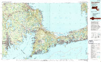
1994 Map of New Bedford
USGS Topo · Published 1994About this map
Cape Cod Bay and Buzzards Bay define the coastal character of this late-twentieth-century survey, which documents the maritime and terrestrial infrastructure of southeastern Massachusetts. The industrial and fishing heritage of New Bedford and Fairhaven anchors the western edge, while the engineering of the Cape Cod Canal serves as the gateway to the outer Cape. This edition highlights significant federal and state land management, including the expansive Otis Air Force Base, the protected shoreline of the Cape Cod National Seashore, and the migratory habitat of the Monomoy National Wildlife Refuge. Moving inland, the map shows a network of freshwater bodies such as Assawompset Pond and Long Pond situated near Middleborough, alongside the established woodland of the Myles Standish State Forest. The transport corridor is marked by the Mid-Cape Highway and the Cape Cod RR, illustrating how the region's seasonal tourism and year-round commerce integrated with the landscape by the 1990s.
Find a feature on this map
169 named features on this map. Tap any name to fly to it.
Don’t see what you’re looking for? This feature index may not catch every label — zoom into the map to look around manually.
Map Details
Editions of this 1994 New Bedford Map
This is the sole edition of this map. No revisions or reprints were ever made.
Other maps of this area

1885 · New Bedford
USGS Topo · 1:62,500

1885 · Abington
USGS Topo · 1:62,500

1885 · Sakonnet
USGS Topo · 1:62,500

1885 · Duxbury
USGS Topo · 1:62,500

1885 · Middleboro
USGS Topo · 1:62,500

1885 · Taunton
USGS Topo · 1:62,500

1886 · Falmouth
USGS Topo · 1:62,500

1886 · Plymouth
USGS Topo · 1:62,500

1886 · Dedham
USGS Topo · 1:62,500

1887 · Gay Head
USGS Topo · 1:62,500