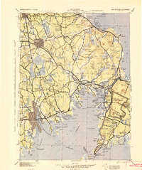
1942 Map of New Bedford
USGS Topo · Published 1942About this map
The coastal landscapes of Southeastern Massachusetts are documented here during the early 1940s, highlighting the strategic and industrial importance of the region as the country entered World War II. The massive extent of Camp Edwards occupies the eastern portion of the sheet, reflecting the wartime mobilization of the era. To the west, the industrial hubs of Middleboro and the outskirts of New Bedford are connected by the dense rail network of the New York New Haven and Hartford RR, which served as the primary artery for both passengers and freight.
Find a feature on this map
265 named features on this map. Tap any name to fly to it.
Don’t see what you’re looking for? This feature index may not catch every label — zoom into the map to look around manually.
Map Details
Editions of this 1942 New Bedford Map
2 editions found
Other maps of this area

1885 · New Bedford
USGS Topo · 1:62,500

1885 · Abington
USGS Topo · 1:62,500

1885 · Sakonnet
USGS Topo · 1:62,500

1885 · Duxbury
USGS Topo · 1:62,500

1885 · Middleboro
USGS Topo · 1:62,500

1885 · Taunton
USGS Topo · 1:62,500

1886 · Falmouth
USGS Topo · 1:62,500

1886 · Plymouth
USGS Topo · 1:62,500

1886 · Dedham
USGS Topo · 1:62,500

1887 · Gay Head
USGS Topo · 1:62,500