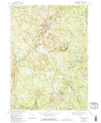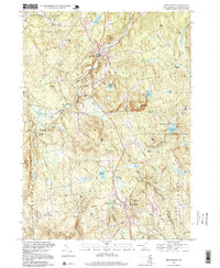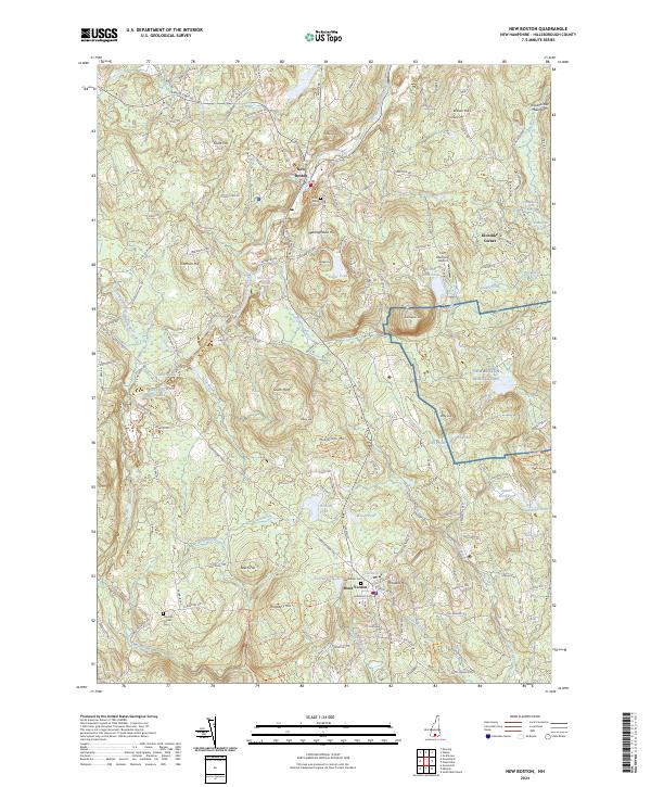
2024 Map of New Boston
USGS Topo · Published 2024About this map
New Boston serves as the central hub of this hilly Hillsborough County landscape, where the South Branch Piscataquog River winds past Clark Hill and Meetinghouse Hill. The settlement pattern reflects deep-rooted local history, from the cluster of buildings at Mont Vernon to the outlying crossroads of Klondike Corner and Johnson Corner. Modern infrastructure is prominently represented by the New Boston Air Station, which occupies a significant tract of land east of Joe English Hill. Genealogists will find interest in the documented locations of the New Boston Cem and Greenlawn Cem. The terrain is defined by a dense network of named peaks and water bodies, including Purgatory Falls and McGregors Pond, connected by historic routes like the Francestown Tpke and Boston Post Rd.
Find a feature on this map
64 named features on this map. Tap any name to fly to it.
Don’t see what you’re looking for? This feature index may not catch every label — zoom into the map to look around manually.
Map Details
Editions of this 2024 New Boston Map
This is the sole edition of this map. No revisions or reprints were ever made.
Historical Maps of Mont Vernon Through Time
3 maps found