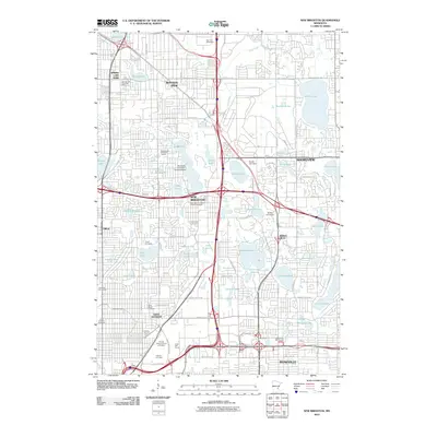
2010 Map of New Brighton
USGS Topo · Published 2010About this map
The suburban landscape north of Minneapolis is defined by its extensive lacustrine geography, where major settlements like New Brighton, Mounds View, and Shoreview are tightly integrated with numerous lakes and creeks. Waterways such as Rice Creek and Long Lake weave through a network of major transit corridors including County Hwy 10 and Snelling Ave N. The area shows a high density of recreational and institutional space, including the Bethel University campus near Valentine Lake and the Twin City Speedway to the north. A significant concentration of memorial sites, such as Hillside Cemetery and Sunset Memorial Park Cemetery, occupies the southern portion of the quadrangle near Saint Anthony, reflecting the long-established community foundations of these northern twin cities. Unique landmarks like the Rosackers Number 1 Seaplane Base on Pike Lake highlight the region's specialized aviation and water-based history.
Find a feature on this map
93 named features on this map. Tap any name to fly to it.
Don’t see what you’re looking for? This feature index may not catch every label — zoom into the map to look around manually.
Map Details
Editions of this 2010 New Brighton Map
This is the sole edition of this map. No revisions or reprints were ever made.
Other maps of this area

1896 · Minneapolis
USGS Topo · 1:62,500

1896 · St. Paul
USGS Topo · 1:62,500

1901 · Minneapolis
USGS Topo · 1:62,500

1902 · White Bear
USGS Topo · 1:62,500

1902 · Anoka
USGS Topo · 1:62,500

1951 · St. Paul West
USGS Topo · 1:24,000

1951 · St. Paul East
USGS Topo · 1:24,000

1951 · St. Paul
USGS Topo · 1:62,500

1952 · Centerville
USGS Topo · 1:24,000

1952 · White Bear Lake West
USGS Topo · 1:24,000