
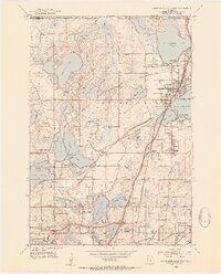
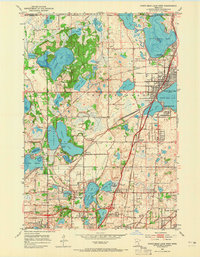
1952 Map of White Bear Lake West
USGS Topo · Published 1954About this map
Pleasant Lake and Vadnais Lake anchor this 1950s landscape, which illustrates the transition of northern Ramsey County from rural acreage to suburban infrastructure. The presence of the St Paul Waterworks, a prominent Pumping Station, and the Aqueduct system reveals how the region’s abundant surface water was already being harnessed for urban utility. The rail networks of the Northern Pacific and the Chicago St Paul Minneapolis and Omaha RR converge at transit points like Cardigan Junction, facilitating the growth of settlements such as Little Canada and White Bear Lake. Neighborhood development is evidenced by numerous local institutions, including the Davidson Sch, Snail Lake Sch, and the Union Mission Camp. Along the eastern shore of Bald Eagle Lake, the community of Bald Eagle and its Fairground stand as established local landmarks amidst a terrain dotted with cemeteries like Bethany Cem.
Find a feature on this map
76 named features on this map. Tap any name to fly to it.
Don’t see what you’re looking for? This feature index may not catch every label — zoom into the map to look around manually.
Map Details
Editions of this 1952 White Bear Lake West Map
3 editions found
Other maps of this area

1896 · St. Paul
USGS Topo · 1:62,500

1902 · White Bear
USGS Topo · 1:62,500

1946 · Hudson
USGS Topo · 1:62,500

1948 · Stillwater
USGS Topo · 1:62,500

1949 · Hudson
USGS Topo · 1:62,500

1949 · Stillwater
USGS Topo · 1:62,500

1949 · Lake Elmo
USGS Topo · 1:24,000

1950 · Lake Elmo
USGS Topo · 1:24,000

1951 · White Bear Lake East
USGS Topo · 1:24,000

1951 · St. Paul West
USGS Topo · 1:24,000