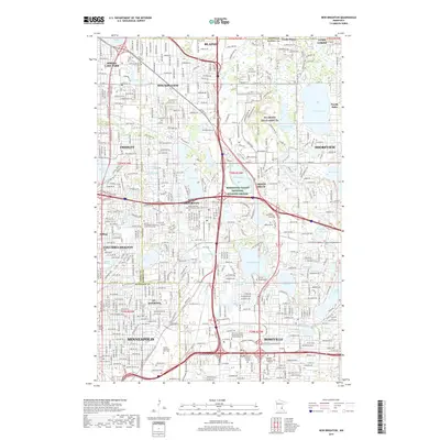
2019 Map of New Brighton
USGS Topo · Published 2019About this map
The dense northern suburbs of Minneapolis are mapped here at a time of significant institutional and residential maturity. Notable for its concentration of higher education and religious centers, the area includes the United Theological Seminary of the Twin Cities, Bethel Univ, and the Univ of Northwestern. The landscape is defined by the glacial lakes and waterways typical of this part of Minnesota, with Rice Creek winding through Fridley and Mounds View, while substantial bodies of water like Lake Johanna, Long Lake, and Turtle Lake serve as anchors for the surrounding communities. Historical researchers will find numerous established cemeteries, such as Sunset Memorial Park Cem and Hillside Cem, alongside the sprawling NG Arden Hills Army TS. Conservation efforts are represented by the Minnesota Valley National Wildlife Refuge, which provides a protected corridor amidst the suburban development.
Find a feature on this map
84 named features on this map. Tap any name to fly to it.
Don’t see what you’re looking for? This feature index may not catch every label — zoom into the map to look around manually.
Map Details
Editions of this 2019 New Brighton Map
This is the sole edition of this map. No revisions or reprints were ever made.
Other maps of this area

1896 · Minneapolis
USGS Topo · 1:62,500

1896 · St. Paul
USGS Topo · 1:62,500

1901 · Minneapolis
USGS Topo · 1:62,500

1902 · White Bear
USGS Topo · 1:62,500

1902 · Anoka
USGS Topo · 1:62,500

1951 · St. Paul West
USGS Topo · 1:24,000

1951 · St. Paul East
USGS Topo · 1:24,000

1951 · St. Paul
USGS Topo · 1:62,500

1952 · Centerville
USGS Topo · 1:24,000

1952 · White Bear Lake West
USGS Topo · 1:24,000