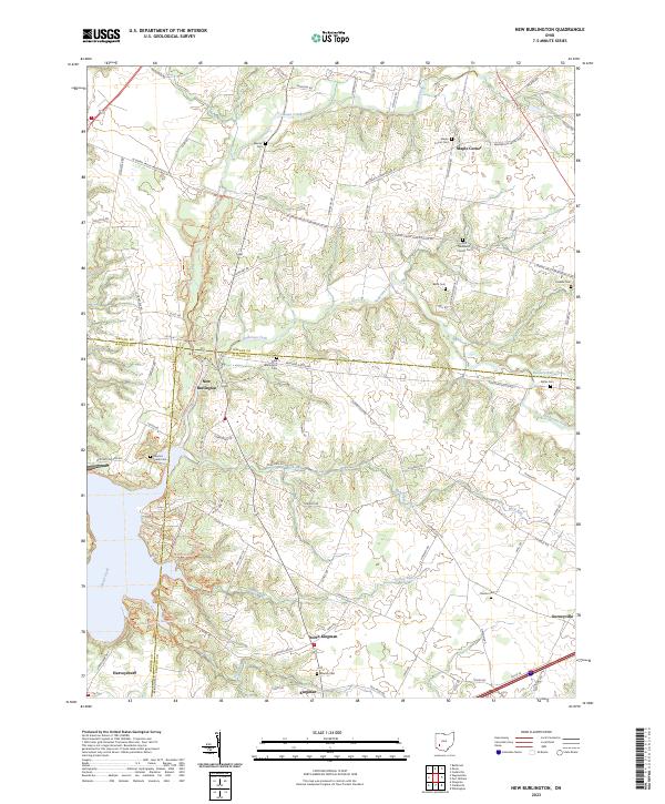
2023 Map of New Burlington
USGS Topo · Published 2023About this map
Caesar Creek and Anderson Fork define the topography of this corner of Southwestern Ohio, where the borders of Greene, Warren, and Clinton counties converge. The area is characterized by scattered rural settlements and a significant concentration of family and community burial grounds, including the Zoar Methodist Church Cem and the Caesars Creek Cem. These sites, along with smaller plots like Mercer Cem and Babb Cem, offer important data points for genealogists tracing early families in the region.
Find a feature on this map
82 named features on this map. Tap any name to fly to it.
Don’t see what you’re looking for? This feature index may not catch every label — zoom into the map to look around manually.
Map Details
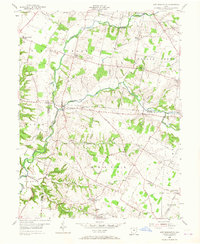
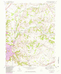
Editions of this 2023 New Burlington Map
This is the sole edition of this map. No revisions or reprints were ever made.
Historical Maps of Kingman Through Time
3 maps found
Featured Locations
- Harveysburg, OH
- Caesarscreek Township, OH
- Spring Valley Township, OH
- Maple Corner, Caesarscreek Township
- Kingman, Chester Township