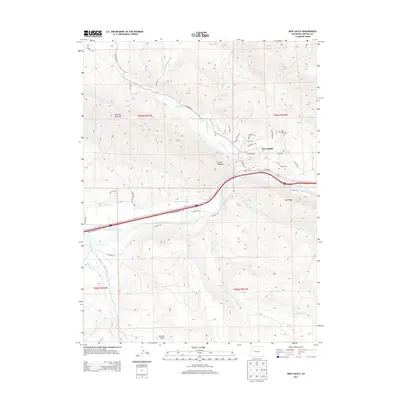
2013 Map of New Castle
USGS Topo · Published 2013About this map
New Castle sits at the base of the Grand Hogback, where the valley opens toward the Colorado River. This early twenty-first-century survey illustrates the intricate irrigation infrastructure essential to the region, including the Tompkins Ditch, Ware and Hinds Ditch, and Lower Cactus Valley Ditch which draw from the river and its tributaries. The landscape is defined by its deep drainages, such as Slaughter Gulch and Jackson Gulch, and the prominent rise of Burning Mountain to the northwest. Beyond the residential developments of New Castle, the map shows the proximity of Coal Ridge and the High Land Cem, reflecting the local topography and community landmarks. The convergence of Elk Creek, Main Elk Creek, and East Elk Creek highlights the drainage patterns that have historically shaped settlement and land use in this part of Garfield County.
Find a feature on this map
45 named features on this map. Tap any name to fly to it.
Don’t see what you’re looking for? This feature index may not catch every label — zoom into the map to look around manually.
Map Details
Editions of this 2013 New Castle Map
This is the sole edition of this map. No revisions or reprints were ever made.
Other maps of this area

1906 · Grand Hogback
USGS Topo · 1:125,000

1910 · Grand Hogback
USGS Topo · 1:125,000

1927 · Glenwood Springs
USGS Topo · 1:125,000

1930 · Glenwood Springs
USGS Topo · 1:125,000

1957 · Leadville
USGS Topo · 1:250,000

1959 · Leadville
USGS Topo · 1:250,000

1960 · Leadville
USGS Topo · 1:250,000

1962 · Leadville
USGS Topo · 1:250,000

1962 · New Castle
USGS Topo · 1:24,000

1962 · Storm King Mountain
USGS Topo · 1:24,000