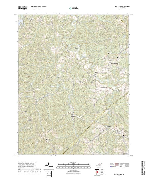
2022 Map of New Columbus
USGS Topo · Published 2022About this map
New Columbus and the surrounding rural landscape of Owen County are defined by the winding course of Eagle Creek and its many tributaries. This area is characterized by scattered upland settlements and numerous family and community burial grounds, such as the Hughes Cem and Fairview Cem. The map reveals a high density of country churches and associated cemeteries that anchor the local geography, including the Bethany Christian Church Cem and Caney Fork Baptist Church Cem. A prominent topographic feature, Mountain Island, rises near the center of the sheet, partially encircled by the creek's meanders.
Find a feature on this map
86 named features on this map. Tap any name to fly to it.
Don’t see what you’re looking for? This feature index may not catch every label — zoom into the map to look around manually.
Map Details
Editions of this 2022 New Columbus Map
This is the sole edition of this map. No revisions or reprints were ever made.
Other maps of this area

1906 · Lockport
USGS Topo · 1:48,000

1908 · Lockport
USGS Topo · 1:62,500

1939 · Sadieville
USGS Topo · 1:62,500

1950 · Mason
USGS Topo · 1:24,000

1950 · Owenton
USGS Topo · 1:24,000

1950 · Lawrenceville
USGS Topo · 1:24,000

1953 · Monterey
USGS Topo · 1:24,000

1953 · Sadieville
USGS Topo · 1:24,000
1953 · Stamping Ground
USGS Topo · 1:24,000
1953 · New Columbus
USGS Topo · 1:24,000