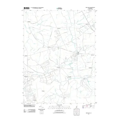
2011 Map of New Egypt
USGS Topo · Published 2011About this map
McGuire Air Force Base and the expansive grounds of Fort Dix dominate the southwestern quadrant of this landscape, reflecting the significant military presence that has shaped the region's development. In contrast to these high-activity installations, the village of New Egypt sits at the center of a network of rural roads, situated along the waters of Oakford Lake and its corresponding Oakford Lake Dam. The terrain is defined by a series of waterways, including Crosswicks Creek and Lahaway Creek, which cut through the agricultural and wooded surroundings.
Find a feature on this map
108 named features on this map. Tap any name to fly to it.
Don’t see what you’re looking for? This feature index may not catch every label — zoom into the map to look around manually.
Map Details
Editions of this 2011 New Egypt Map
This is the sole edition of this map. No revisions or reprints were ever made.
Other maps of this area

1884 · Whitings
USGS Topo · 1:62,500

1888 · Bordentown
USGS Topo · 1:62,500

1888 · Pemberton
USGS Topo · 1:62,500

1888 · Cassville
USGS Topo · 1:62,500

1888 · Whitings
USGS Topo · 1:62,500

1893 · Bordentown
USGS Topo · 1:62,500

1894 · Cassville
USGS Topo · 1:62,500

1894 · Pemberton
USGS Topo · 1:62,500

1898 · Pemberton
USGS Topo · 1:62,500

1900 · Cassville
USGS Topo · 1:62,500
Featured Places
- Plumsted Township, NJ
- Upper Freehold Township, NJ
- Chesterfield Township, NJ
- Springfield Township, NJ
- Wrightstown, NJ