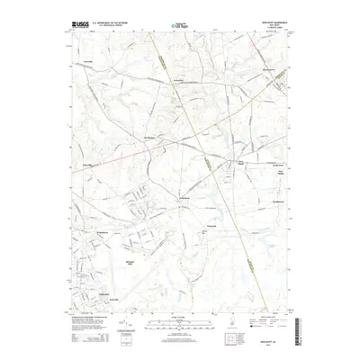
2014 Map of New Egypt
USGS Topo · Published 2014About this map
The sprawling military installations of Fort Dix and McGuire AFB dominate the southern half of this landscape at the intersection of Ocean, Burlington, and Monmouth counties. These expansive federal grounds contrast sharply with the established village centers and agricultural tracts to the north. Historical settlements such as New Egypt, Wrightstown, and Jacobstown are shown with their detailed street grids, serving as anchor points for the surrounding rural road network.
Find a feature on this map
153 named features on this map. Tap any name to fly to it.
Don’t see what you’re looking for? This feature index may not catch every label — zoom into the map to look around manually.
Map Details
Editions of this 2014 New Egypt Map
This is the sole edition of this map. No revisions or reprints were ever made.
Other maps of this area

1884 · Whitings
USGS Topo · 1:62,500

1888 · Bordentown
USGS Topo · 1:62,500

1888 · Pemberton
USGS Topo · 1:62,500

1888 · Cassville
USGS Topo · 1:62,500

1888 · Whitings
USGS Topo · 1:62,500

1893 · Bordentown
USGS Topo · 1:62,500

1894 · Cassville
USGS Topo · 1:62,500

1894 · Pemberton
USGS Topo · 1:62,500

1898 · Pemberton
USGS Topo · 1:62,500

1900 · Cassville
USGS Topo · 1:62,500
Featured Places
- Plumsted Township, NJ
- Upper Freehold Township, NJ
- Chesterfield Township, NJ
- Springfield Township, NJ
- Wrightstown, NJ