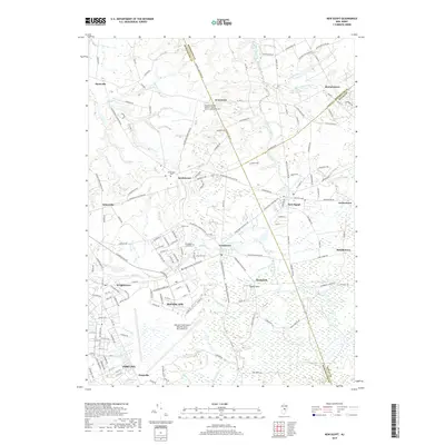
2019 Map of New Egypt
USGS Topo · Published 2019About this map
McGuire AFB and the expansive northern grounds of Fort Dix dominate the southern half of this landscape, illustrating the significant military footprint in this part of New Jersey. The surrounding terrain is a mixture of small settlements and wetlands, where the Brigadier General William C Doyle Veterans Memorial Cem sits near Arneytown at the Monmouth County border. The drainage patterns are intricate, with Lahaway Creek and Crosswicks Creek carving through the northern reaches, while the south is marked by specialized features like Amphibious Lake. Older villages like Jacobstown and New Egypt maintain their traditional footprints amidst a modernizing road network, including the McGuire Access Hwy. From the academic grounds of Wilmington University to the elevations of Taylors Mtn, the map captures the transition from active military installations to the quiet cranberry bogs and streams of the rural interior.
Find a feature on this map
162 named features on this map. Tap any name to fly to it.
Don’t see what you’re looking for? This feature index may not catch every label — zoom into the map to look around manually.
Map Details
Editions of this 2019 New Egypt Map
This is the sole edition of this map. No revisions or reprints were ever made.
Other maps of this area

1884 · Whitings
USGS Topo · 1:62,500

1888 · Bordentown
USGS Topo · 1:62,500

1888 · Pemberton
USGS Topo · 1:62,500

1888 · Cassville
USGS Topo · 1:62,500

1888 · Whitings
USGS Topo · 1:62,500

1893 · Bordentown
USGS Topo · 1:62,500

1894 · Cassville
USGS Topo · 1:62,500

1894 · Pemberton
USGS Topo · 1:62,500

1898 · Pemberton
USGS Topo · 1:62,500

1900 · Cassville
USGS Topo · 1:62,500
Featured Places
- Plumsted Township, NJ
- Upper Freehold Township, NJ
- Chesterfield Township, NJ
- Springfield Township, NJ
- Wrightstown, NJ