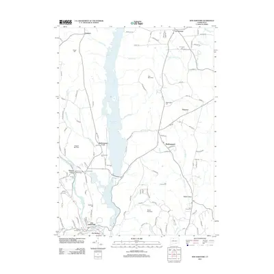
2012 Map of New Hartford
USGS Topo · Published 2012About this map
Barkhamsted Reservoir dominates the central corridor of this Litchfield and Hartford County region, marking a landscape defined by significant water management and rural settlement patterns. The massive reservoir and the adjacent Lake McDonough to the south create a central axis flanked by ridges like Pine Mountain and Ratlum Mountain. Historically significant points of interest are scattered throughout the hills, including the civic and religious sites of Barkhamsted Center and the village of Pleasant Valley along the W Br Farmington River. Local history is anchored by several burial grounds, such as the Riverside Cem and Barkhamsted Cem, which provide essential touchpoints for genealogical research. The map also traces the winding courses of Cherry Brook and Roaring Brook, reflecting the complex drainage system of this upland Connecticut terrain during the early 21st century.
Find a feature on this map
120 named features on this map. Tap any name to fly to it.
Don’t see what you’re looking for? This feature index may not catch every label — zoom into the map to look around manually.
Map Details
Editions of this 2012 New Hartford Map
This is the sole edition of this map. No revisions or reprints were ever made.
Other maps of this area

1887 · Granville
USGS Topo · 1:62,500

1888 · Sandisfield
USGS Topo · 1:62,500

1889 · Granville
USGS Topo · 1:62,500

1892 · Winsted
USGS Topo · 1:62,500

1892 · Granby
USGS Topo · 1:62,500

1893 · Granville
USGS Topo · 1:62,500

1893 · Sandisfield
USGS Topo · 1:62,500

1895 · Granville
USGS Topo · 1:62,500

1896 · Holyoke
USGS Topo · 1:125,000

1897 · Sandisfield
USGS Topo · 1:62,500