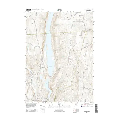
2015 Map of New Hartford
USGS Topo · Published 2015About this map
Barkhamsted Reservoir and Lake McDonough dominate the central valley of this Litchfield and Hartford County border region, illustrating the massive scale of 20th-century water management infrastructure. The map traces the West Branch Farmington River as it flows south toward New Hartford and the industrial-era settlement of Pine Meadow. The elevation profiles of Pine Mtn and Washington Hill provide a clear view of the upland terrain surrounding these basins. For those tracing family histories, the sheet identifies several key burial grounds including Barkhamsted Cem and Riverside Cem. The road network connects older hubs like Pleasant Valley and North Canton, showing how contemporary transit routes follow the traditional valley corridors between Ragged Mtn and the West Mountains.
Find a feature on this map
113 named features on this map. Tap any name to fly to it.
Don’t see what you’re looking for? This feature index may not catch every label — zoom into the map to look around manually.
Map Details
Editions of this 2015 New Hartford Map
This is the sole edition of this map. No revisions or reprints were ever made.
Other maps of this area

1887 · Granville
USGS Topo · 1:62,500

1888 · Sandisfield
USGS Topo · 1:62,500

1889 · Granville
USGS Topo · 1:62,500

1892 · Winsted
USGS Topo · 1:62,500

1892 · Granby
USGS Topo · 1:62,500

1893 · Granville
USGS Topo · 1:62,500

1893 · Sandisfield
USGS Topo · 1:62,500

1895 · Granville
USGS Topo · 1:62,500

1896 · Holyoke
USGS Topo · 1:125,000

1897 · Sandisfield
USGS Topo · 1:62,500