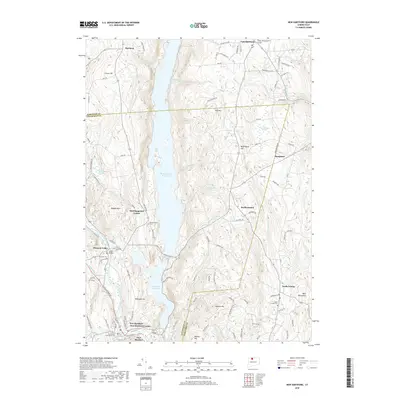
2018 Map of New Hartford
USGS Topo · Published 2018About this map
The Barkhamsted Reservoir dominates the central corridor of this Litchfield and Hartford County borderland, its waters filling the valley between Pine Mtn and Ragged Mtn. The landscape is a mosaic of small village centers and high ridgelines, including Barkhamsted Center and New Hartford. To the south, Lake Mc Donough sits just above New Hartford Center, while the West Branch Farmington River snakes through the western portion of the terrain near Pleasant Valley. Genealogy researchers will find several well-documented burial grounds, such as Riverside Cem and Pine Grove Cem, which serve as physical markers of the area's long-established communities. The transition from the highland plateaus of Hartland in the north to the lower reaches of Pine Meadow reflects a settlement pattern closely tied to the available water power and valley floor geography.
Find a feature on this map
112 named features on this map. Tap any name to fly to it.
Don’t see what you’re looking for? This feature index may not catch every label — zoom into the map to look around manually.
Map Details
Editions of this 2018 New Hartford Map
This is the sole edition of this map. No revisions or reprints were ever made.
Other maps of this area

1887 · Granville
USGS Topo · 1:62,500

1888 · Sandisfield
USGS Topo · 1:62,500

1889 · Granville
USGS Topo · 1:62,500

1892 · Winsted
USGS Topo · 1:62,500

1892 · Granby
USGS Topo · 1:62,500

1893 · Granville
USGS Topo · 1:62,500

1893 · Sandisfield
USGS Topo · 1:62,500

1895 · Granville
USGS Topo · 1:62,500

1896 · Holyoke
USGS Topo · 1:125,000

1897 · Sandisfield
USGS Topo · 1:62,500