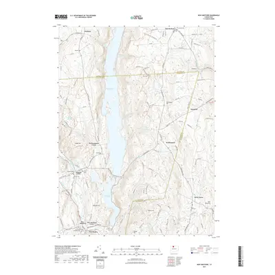
2021 Map of New Hartford
USGS Topo · Published 2021About this map
Barkhamsted Reservoir dominates the central landscape of this Litchfield and Hartford County region, serving as a massive hydraulic centerpiece for the surrounding valley. The reservoir and nearby Lake Mc Donough represent significant mid-century water management infrastructure, overseen by the Metropolitan District. To the west, the West Branch Farmington River winds through Pleasant Valley, where historical cemeteries like Riverside Cem sit near the riverbanks. The settlement pattern shows a concentration of local activity at New Hartford and Pine Meadow in the south, while higher elevations like Ratlum Mtn and Pine Mtn define the upland terrain. Local historians can trace the network of forest trails such as the Peoples Forest Trl and Elliot Bronson Trl that navigate the ridges between the reservoir and the river valley.
Find a feature on this map
123 named features on this map. Tap any name to fly to it.
Don’t see what you’re looking for? This feature index may not catch every label — zoom into the map to look around manually.
Map Details
Editions of this 2021 New Hartford Map
This is the sole edition of this map. No revisions or reprints were ever made.
Other maps of this area

1887 · Granville
USGS Topo · 1:62,500

1888 · Sandisfield
USGS Topo · 1:62,500

1889 · Granville
USGS Topo · 1:62,500

1892 · Winsted
USGS Topo · 1:62,500

1892 · Granby
USGS Topo · 1:62,500

1893 · Granville
USGS Topo · 1:62,500

1893 · Sandisfield
USGS Topo · 1:62,500

1895 · Granville
USGS Topo · 1:62,500

1896 · Holyoke
USGS Topo · 1:125,000

1897 · Sandisfield
USGS Topo · 1:62,500