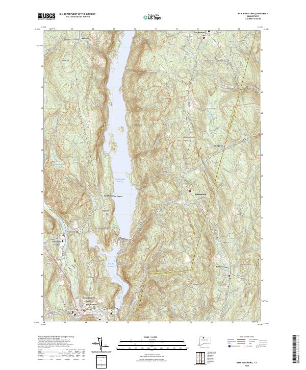
2024 Map of New Hartford
USGS Topo · Published 2024About this map
The Barkhamsted Reservoir dominates the central landscape of this Litchfield County quadrangle, a massive water body that reshaped the region's topography and settlement patterns. To the south, the village of New Hartford and New Hartford Center serve as focal points for local history, featuring several significant burial sites including Village Cem and Pine Grove Cem. The geography is defined by prominent elevations such as Pine Mtn and Ratlum Mtn, with the protected woodlands of Peoples Forest and the Northwest Hills Planning Region preserving the area's natural character. Along the western edge, the West Branch Farmington Wild and Scenic River flows past Pleasant Valley, where the Riverside Cem remains a notable landmark for genealogists. The map also captures the eastern extent of the area near North Canton, showing the transition from steep ridges like West Ledge to the valley of Cherry Brook.
Find a feature on this map
105 named features on this map. Tap any name to fly to it.
Don’t see what you’re looking for? This feature index may not catch every label — zoom into the map to look around manually.
Map Details
Editions of this 2024 New Hartford Map
This is the sole edition of this map. No revisions or reprints were ever made.
Other maps of this area

1887 · Granville
USGS Topo · 1:62,500

1888 · Sandisfield
USGS Topo · 1:62,500

1889 · Granville
USGS Topo · 1:62,500

1892 · Winsted
USGS Topo · 1:62,500

1892 · Granby
USGS Topo · 1:62,500

1893 · Granville
USGS Topo · 1:62,500

1893 · Sandisfield
USGS Topo · 1:62,500

1895 · Granville
USGS Topo · 1:62,500

1896 · Holyoke
USGS Topo · 1:125,000

1897 · Sandisfield
USGS Topo · 1:62,500