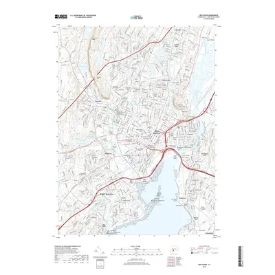
2018 Map of New Haven
USGS Topo · Published 2018About this map
New Haven and the surrounding coastline of the Long Island Sound appear here as a densely developed educational and maritime hub. The presence of Yale University and its School of Medicine anchors the city center, which is framed by historical burial grounds such as the Grove Street Cemetery and the New Haven Crypt Cemetery. To the west, the landscape rises toward the Metacomet Ridge and West Rock Ridge, with the West Rock Tunnel providing a critical passage through the traprock cliffs. The shoreline is defined by a complex network of points and bars, including Wigwam Neck and Sandy Point Flats, while New Haven Harbor serves as the focal point for the region's river-and-sea commerce. Residential growth is evident in established neighborhoods like Spring Glen, Westville, and Fair Haven, while the southern reaches of West Haven extend toward the notable Savin Rock Bluff.
Find a feature on this map
111 named features on this map. Tap any name to fly to it.
Don’t see what you’re looking for? This feature index may not catch every label — zoom into the map to look around manually.
Map Details
Editions of this 2018 New Haven Map
This is the sole edition of this map. No revisions or reprints were ever made.
Other maps of this area

1889 · Derby
USGS Topo · 1:62,500

1891 · Bridgeport
USGS Topo · 1:62,500

1891 · Derby
USGS Topo · 1:62,500

1892 · New Haven
USGS Topo · 1:62,500

1893 · Bridgeport
USGS Topo · 1:62,500

1893 · Derby
USGS Topo · 1:62,500

1920 · Bridgeport
USGS Topo · 1:62,500

1921 · New Haven
USGS Topo · 1:62,500

1943 · New Haven
USGS Topo · 1:31,680

1943 · Naugatuck
USGS Topo · 1:31,680