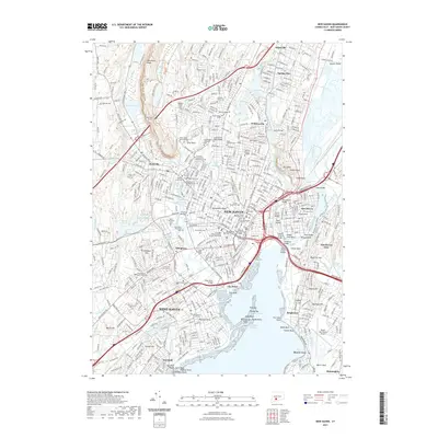
2021 Map of New Haven
USGS Topo · Published 2021About this map
New Haven and the surrounding coastline are defined by the convergence of the Mill River, Quinnipiac River, and West River. This survey illustrates a densely populated urban corridor where institutional history is deeply rooted, anchored by the Yale School of Medicine and University of New Haven. The landscape is physically divided by the Metacomet Ridge, which forces transportation through the West Rock Tunnel. Cultural and genealogical depth is evident in the numerous historic burying grounds, ranging from the Grove Street Cem near the city center to the Saint Bernards and several Jewish memorial parks such as Bnai Jacob Memorial Park. The coastal edge reveals the industrial and maritime infrastructure of City Point and the aviation hub of Tweed-New Haven Airport, while inland areas like Westville and Allingtown show the expansion of residential and educational districts away from the harbor.
Find a feature on this map
84 named features on this map. Tap any name to fly to it.
Don’t see what you’re looking for? This feature index may not catch every label — zoom into the map to look around manually.
Map Details
Editions of this 2021 New Haven Map
This is the sole edition of this map. No revisions or reprints were ever made.
Other maps of this area

1889 · Derby
USGS Topo · 1:62,500

1891 · Bridgeport
USGS Topo · 1:62,500

1891 · Derby
USGS Topo · 1:62,500

1892 · New Haven
USGS Topo · 1:62,500

1893 · Bridgeport
USGS Topo · 1:62,500

1893 · Derby
USGS Topo · 1:62,500

1920 · Bridgeport
USGS Topo · 1:62,500

1921 · New Haven
USGS Topo · 1:62,500

1943 · New Haven
USGS Topo · 1:31,680

1943 · Naugatuck
USGS Topo · 1:31,680