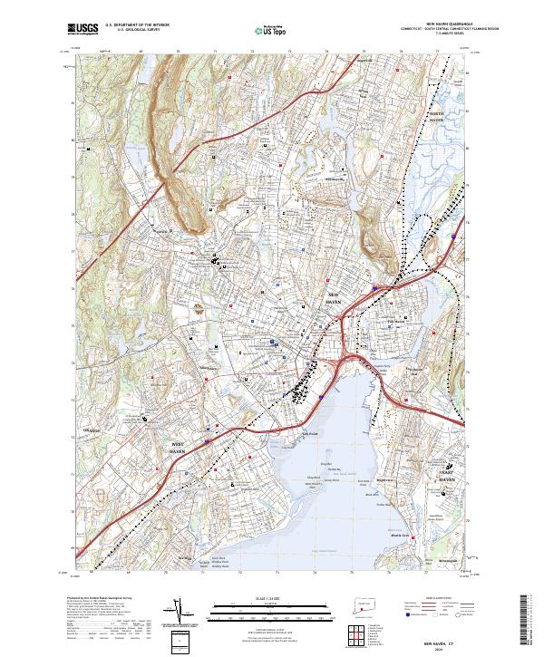
2024 Map of New Haven
USGS Topo · Published 2024About this map
New Haven and its surrounding harbor communities are defined by a dense urban core and significant educational institutions. The campus of Yale University occupies a central position, adjacent to the historic Grove Street Cem and the Trinity Church on the Green. The map illustrates the city’s complex geography, where the Quinnipiac River and Mill River meet at New Haven Harbor, creating distinct peninsulas like City Point and the prominently named Dragon Point.
Find a feature on this map
123 named features on this map. Tap any name to fly to it.
Don’t see what you’re looking for? This feature index may not catch every label — zoom into the map to look around manually.
Map Details
Editions of this 2024 New Haven Map
This is the sole edition of this map. No revisions or reprints were ever made.
Other maps of this area

1889 · Derby
USGS Topo · 1:62,500

1891 · Bridgeport
USGS Topo · 1:62,500

1891 · Derby
USGS Topo · 1:62,500

1892 · New Haven
USGS Topo · 1:62,500

1893 · Bridgeport
USGS Topo · 1:62,500

1893 · Derby
USGS Topo · 1:62,500

1920 · Bridgeport
USGS Topo · 1:62,500

1921 · New Haven
USGS Topo · 1:62,500

1943 · New Haven
USGS Topo · 1:31,680

1943 · Naugatuck
USGS Topo · 1:31,680