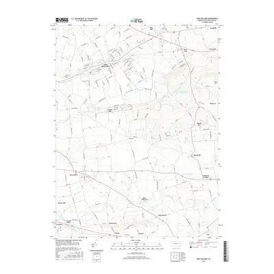
2016 Map of New Holland
USGS Topo · Published 2016About this map
The borough of New Holland serves as a central hub in this survey of eastern Lancaster County, where the dense grid of residential streets like N Railroad Ave and E Conestoga St gives way to the productive agricultural landscape of the Pennsylvania Dutch country. This region is characterized by a high concentration of historic hamlets and villages, including the uniquely named Intercourse, Blue Ball, and Paradise. The southern portion of the map is defined by the corridor of the Strasburg RR and the winding course of Pequea Creek, marking a transition from the industrial and commercial activity in the north to the fertile valley floors below Welsh Mtn. The landscape is etched with numerous small waterways such as Muddy Run, Umbles Run, and Groff Run, which supported the early mills and farms of the area's diverse settlements, from Fetterville to Leaman Place.
Find a feature on this map
144 named features on this map. Tap any name to fly to it.
Don’t see what you’re looking for? This feature index may not catch every label — zoom into the map to look around manually.
Map Details
Editions of this 2016 New Holland Map
This is the sole edition of this map. No revisions or reprints were ever made.
Other maps of this area

1904 · Coatesville
USGS Topo · 1:62,500

1905 · Honey Brook
USGS Topo · 1:62,500

1906 · Coatesville
USGS Topo · 1:62,500

1906 · New Holland
USGS Topo · 1:62,500

1907 · Honeybrook
USGS Topo · 1:62,500

1908 · New Holland
USGS Topo · 1:62,500

1912 · Quarryville
USGS Topo · 1:62,500

1918 · Coatesville
USGS Topo · 1:62,500

1941 · Honeybrook
USGS Topo · 1:62,500

1941 · New Holland
USGS Topo · 1:62,500
Featured Places
- East Earl Township, PA
- New Holland, PA
- Paradise Township, PA
- Blue Ball, East Earl Township
- Upper Leacock Township, PA